
 |
| The beautiful NSW high country |
So 2013 dawned
with sunny blue skies and forecast warm weather, today was a rest and travel
day. With the rest of the group heading back to Melbourne, we started our drive
towards the NSW high country through Tallangatta and Khancoban then along the
Alpine way to climb up to the cooler, but still warm and sunny, weather of
Thredbo. We made camp a few kilometres down the Alpine way towards to
Jindabyne, on the banks of the picturesque Thredbo River. Unfortunately the
high volume of human traffic in this part of the high country means the river
water isn’t safe to drink without boiling – but it did provide a pleasant place
to escape the heat and wash off the dust.
We had discovered
that one of the Newy Cogheads was staying at Thredbo with his family so we
arranged for a tour of the local singletrack the next morning, before retiring
to bed for a deliciously cool alpine night.
 |
| visitors at camp |
Thredbo is yet
another ski resort, with a decent history of DH riding, which is currently
trying to develop a cross-country network of trails to attract more summer time
visitors. They currently have a small network of trails based around the
village and lower slops and a trail is being developed that will head down the
river valley and eventually will link into the Crackenback resort trails about
25km downstream.
Unfortunately, we
got the feeling that Thredbo isn’t quite there yet in terms of riding. The
first inkling we got was at the information desk when we were trying to discuss
the trail network with the girl behind the counter. Thredbo have built a
downhill flow trail, similar to the one at Mt Buller and we were keen make the
long uphill grind up from the valley floor to the top lift station to test out
this flowing downhill run. The conversation went something like this”
Me: do we need
full-face helmets for the Flow trail?
Girl: No they
aren’t required.
Me: what’s the
route to the top?
Girl: you get the
lift, you will need to do the $99 induction and if you don’t have full-face
helmets and bikes you can hire them. It’s $299 for the day to hire everything and do the induction.
Me: Can’t we just
ride to the top along this route on the trail map?
Girl: Oh no,
that’s advanced! You need a guide who will assess your skills and do the lift
induction.
Me: we don’t want
to use the lifts, we are XC riders and have XC bikes.
Girl: Then you
need to ride the XC trails in the valley, you can only ride to the top with a
guide and full-face helmets.
Me: Ok so how do
we get to the start of this advanced XC trail (which appeared to start from
half way up the slope)
Girl: you need to
walk up the Flow trail!
 |
| Colourful, but lacks trail direction and sends you up the Flow trail! |
Hmmmm… now at Mt
Buller as an XC rider, you could get on the DH tracks easily as they accessible
from the top of the road, but there’s adequate signage and information and a
general vibe that it’s up to you to take some responsibility for your own
skills and riding experience both on XC and DH trails. Now at Thredbo, we
started to get the feeling that we were being treated like complete idiots.
Having decided
the Flow trail was out of the picture (why build a Flow trail if it’s only open
to DH anyway???) we grabbed another XC trail map and tried to work out a route.
Compared to Mt Buller, Thredbo trail maps suck! First of all, it’s a crappy A4
sheet of paper, which won’t last a day’s riding. Secondly, there no directions
marked on any trails despite some of them being impossible in reverse unless
you are an accomplished trials rider. Feeling distinctly grumpy we headed off
to meet up with Ian for a lap of the valley trails.
 |
| Walking tracks make fun singletrack |
We started the
loop by rolling down the Valley trail – the one that will eventually head 25km
down the valley to Crackenback. At the moment only 3.5km of the trail has been
completed, and it’s a shared use trail of fairly smooth surface and gentle
corners. It’s fun ridden at speed and Tim and I were soon covered in dust from
Ian ripping it into the corners ahead of us. Soon we hit the extent of trail
work and turned around for the gently climbing ride back towards town, but just
before reaching the village we turned a hard right into the Bridle Loop which
offers a few switch backs and rocks to keep the climbing interesting. At this
stage we were starting to feel that there was a bit less oxygen available at
1500m than we were used to.
The Bridle loop
pop you out onto what appears to be a beginner baby ski slope and a trail
switches up that through the summer grass before you’re out onto firetrail. A
bit more climbing and we ducked into some more single track, I think this may
have been walking track but it was great fun with loads of steps and rocks
which required quick on-the-go line choices and behind the saddle action. Then
you pop out again onto firetrail at the top of the summer luge track, wave to
the kiddies and it’s onwards and up again on some more firetrail.
 |
| Sections of rocks, steps and roots :-) |
Then comes the
Thredbo brilliance, you cross the DH track and suddenly you are riding UP the
flow trail. Yup, you can only ride down it with a full-face helmet and
induction but you can ride up it just by correctly following the XC trail map. Of
course we stayed off the side of the trail where we could, but the trail
provides a few narrow points where this is impossible and it’s also hard to see
people coming. A confused DH rider stopped and told us we were on a DH trail, I
don’t blame him for being confused – it’s a bloody stupid idea.
After a few
hundred metres of hard uphill along side the flow trail we ducked into the most
advanced XC trail on the map – Meadows Trail. This actually isn’t an XC trail
but a walking track that they allow bikes on. This means that while you are
negotiating the steps, rocks and roll downs you need also be away of summer
walkers including children who may be on the trail. Following Ian’s big 29er
wheels this track tested the best of my read-and-ride line choice and behind
the saddle abilities. Linked up sections of steps and rocks were all ride-able
and even roll-able but baulk and unclip and you were walking for a while.
That fun ended
all too soon and we were out onto the trail around the golf course. This would
be a fun descent except that so close to the town, the shared trail gets a high
volume of walkers so that you are constantly stopping and starting. After less
than an hour of riding we were back in town having covered 95% of the Thredbo
single track, fun but definitely nothing like what we’d come to expect after
our Alpine riding in Victoria.
 |
| Firetrail to Cascades Hut |
That afternoon we
headed up to Deadhorse Gap to ride one of the firetrails accessible to bikes in
the National Park. The ride out to Cascades Hut is very pretty although it is
100% firetrail with no singletrack. Unfortunately it’s hard to appreciate the
beauty while being attacked by March flies, perhaps we should have picked a
windier day as the still heat was definitely sending the flies crazy.
 |
| Alpine scenery on Cascades Trail |
Over the next
days in Thredbo we explored the Crackenback cross country trails, a fun and
flowing loop of just over half an hour with a decent skills park. All this in a
little self-contained resort complete with Segway tours… odd! And headed back
to the Thredbo trails to play on the more technical trails with their rocks,
roots and steps. We knew that good riding was to be had in Jindabyne and at the
Bundarra trails but the weather was hot even up at Thredbo and the idea of
heading down to Jindy where it was 5-10 degrees hotter was not inviting, we put
those trails on the “next-time” list.
The final day of
riding in Thredbo became a road ride day. We decided that Charlottes Pass was
worthy of an ascent and leaving our camp at 8am we headed down the road towards
Jindabyne. Despite the forecast for a hot day, the alpine nights are cold
leaving before the sun came up would have required vests and warmers.
While the ride to
Jindy is primarily a descent, it does have two decent climbs as you head up and
out of the Thredbo River valley into an adjacent valley before continuing down
towards Lake Jindabyne. It must be a hugely popular area for training camps
because we passed literally hundreds of roadies coming the other way, complete
with support vehicles. Once down at Jindy we met up with Ian and headed along
the road towards Charlottes Pass which follows the lake edge for a little way
before crossing back over the Thredbo river and then commencing the climb. From
the base there’s a fairly constant climb of around 5% for about 13km. From
around 900m elevation at the base you reach 1600m at the 13km point before the
undulations begin, you promptly descend 100m in elevation and the climb another
150m to gap … a pattern that repeats itself several times and sees you pass
through winter ski towns like Perisher and Smiggins Holes. These towns are
eerily ghost-like in summer with deserted buildings, signs creaking the wind
and not a soul in sight except a few confused tourists wondering where everyone
is.
 |
| Add caption |
The total
distance from the base of the climb to Charlottes Pass is about 32km with the
road ending in a locked gate at about 1840m in elevation. For the last 5-10km
of the climb the road weaves through beautiful alpine grassland with mountain
streams running over glacial boulders, a truly beautiful to ride! Topping out
at Charlottes Pass we were met by Ian’s wife and kids in their car, on his 29er
Ian elected to save his off-road tyres by skipping the descent so it was just
Tim and myself on the roadies heading back down to Jindabyne.
 |
| Topping out at Charlotte's Pass |
The undulations
meant that there were still several decent uphills to content with on the ride
back and these were made worse by the return of my friends the March flies…
nothing like uphill motivation than trying to outride something bitey!
Soon though we
were on the 13km descent back to the base of the climb and the temperature was
steadily climbing. The Thredbo river looked so inviting as we crossed at the
bottom and then a hot north-westerly wind hit us as we slogged up the hill back
out of the river valley. Luckily this proved to be mostly a tail wind back into
Jindabyne – a welcome help seeing as we had by now covered 100km and 2000m of
climbing, it was also well over 30 degrees.
We had picked up
my Dad the afternoon before from his 6-day solo hike in the high country and he
met us in Jindabyne with the car for some cold milkshakes and lunch by the
lake. Then it was back to camp for a swim in the river and the final night at
camp. Of course while I drove back to camp Tim decided to ride and, not only
that, but went up to Dead Horse Gap before heading back into camp – why not on
a 33 degree day!
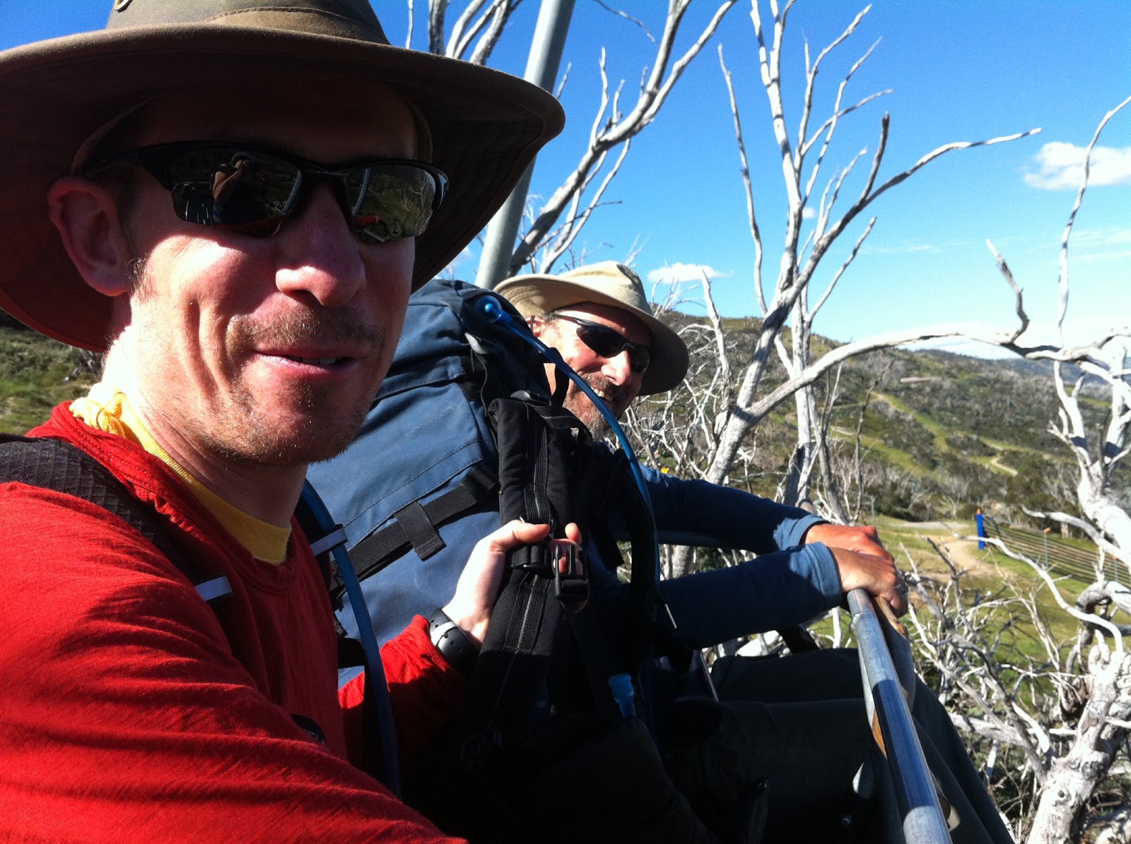 |
| Collecting Dad from the top of the chairlift post hike |
Finally the
holiday was over and it was time to head home, we drove to Canberra for our
first hot shower in two weeks and to drop Dad off with relatives so he could
catch a train back to Melbourne. Canberra greeted us with 39-degree heat so we
decided to give the Canberra singletrack a miss this time and headed out for a dinner
of steak instead. Then after a fitful nights sleep in oppressive heat it was
onto Sydney the next morning for brunch with friends then eventually home to
Newcastle and the reality of unpacking and starting the many, many loads of
washing generated by two weeks of riding…
No comments:
Post a Comment